
Last updated: 10/02/2025
Draft Design Report Comment Period for Congress and Ferry Street
The City of Troy encourages community members to comment on the draft design report.
Mayor Carmella R. Mantello has announced the opening of the comment period for the draft design report for this important Complete Streets project which will transform the Ferry Street entrance into the city as well as provide important pedestrian and bicycle accommodations, while preserving local and business access within the project limits.
The community is invited to comment on the document which has been shaped by prior community input and outlines the existing and proposed conditions of the project.
- Hard copies of the documents will be available at the City of Troy Public Library and at the City Clerk’s Office.
- A digital copy of the report will be available for commenting on the project’s official website.
Results from prior studies have allowed the City of Troy to take the next steps in planning, designing, constructing, and implementing infrastructure improvements along the Route 2 and River Street corridors.
“Improving one of the most visible and traveled gateways into our city is critical to Troy’s future,” said Mayor Carmella R. Mantello. “This project is about more than just traffic flow – it’s about creating a safe, welcoming, and accessible entrance that works for residents, businesses, pedestrians, and cyclists alike. I strongly encourage the community to review the draft design report and share their input so we can deliver a final plan that truly reflects Troy’s needs and priorities.”
Public input is essential to the planning process and developing these accessible corridors for all. Please share your thoughts and comments until November 2nd, 2025.
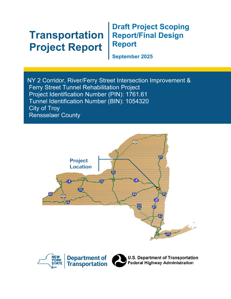
Project Location
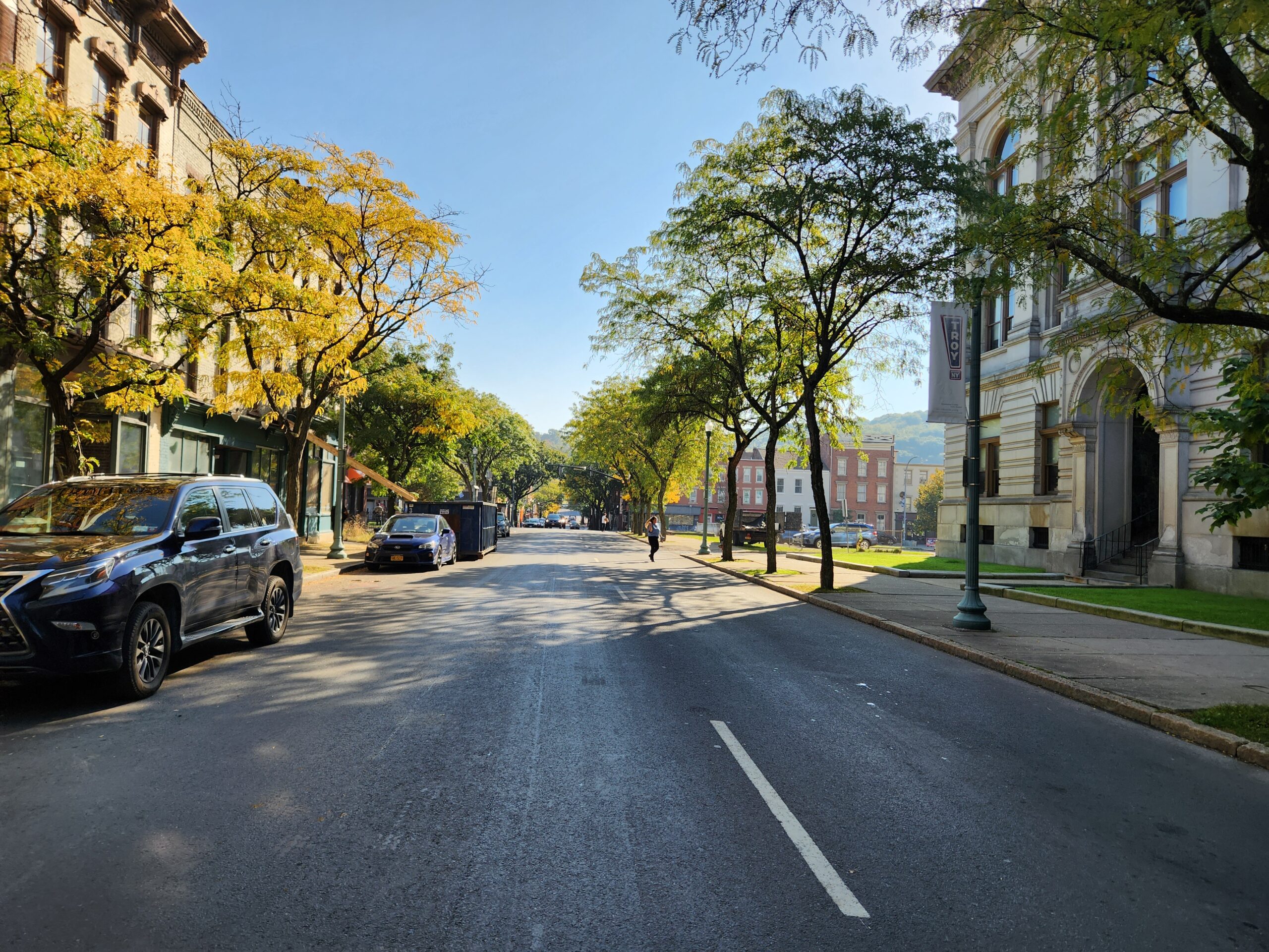
Located in the City of Troy, east of the Congress Street Bridge, the primary area of focus for this project is NY Route 2 from the eastern end of the Congress Street Bridge to 11th Street. NY Route 2 is a one-way pair of roadways with the westbound direction being served by Congress Street and the eastbound direction served by Ferry Street; both of which are currently two-lane roads with adjacent on-street parking. The project also includes a section of River Street from State Street to Liberty Street. Within the project area, River Street is a one-way, southbound road from State Street to Division Street. South of Division Street, River Street is a two-way roadway.
Project Need
NY Route 2 functions as the primary east-west corridor through the downtown urban core of the City of Troy connecting the City of Watervliet with points east of the Hudson River. Through-traffic automobile users are heavily favored along both Congress and Ferry Streets and there are poor accommodations for non-motorized users such as pedestrians and bicyclists. The sidewalks throughout the corridor are in varied condition with numerous sections that are not ADA-compliant due to damage from tree roots as well as non-compliant curb ramps. The existing street trees are in mostly poor condition due to their health and may pose a future public safety concern, in addition to the sidewalk damage that they are causing. The occasional bicyclists must also share the travel lanes with vehicular traffic, which can be dangerous with the numerous types of vehicles along the corridor (transit, trucks, deliveries, etc.)
The current configuration of the Congress Street Bridge interchange tends to mis-direct northbound traffic on River Street to Front Street as a way to access downtown. There is also limited pedestrian and lack of bicycle infrastructure at the intersection. A re-configuration of this interchange into a 4-way intersection will reconnect the City of Troy by eliminating the on and off ramps, as well as tie River Street into proposed development.
Draft Design Report for Public Review
Project Map
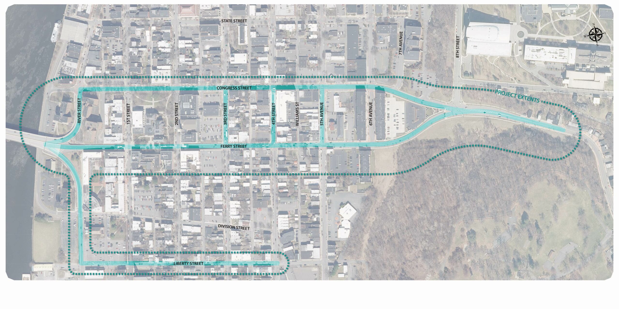
Click to expand
Vision for the Project
Project Purpose
The purpose of this project is to provide increased mobility throughout the City, particularly in this section of downtown. This will be accomplished through the installation of ADA-compliant facilities and bicycle accommodations to provide pedestrians and bicyclists with designated areas. Additionally, the construction of a new 4-way intersection will connect to new developments along River Street and create a gateway into the City. The functionality of the street gride will shift from primarily through-traffic to becoming integral streets that reflect the character and access that the rest of the network provides while also continuing to serve the immediate business, transit, and resident needs. As a true multimodal network, it is anticipated that all users will have designated space to travel using their preferred mode of transportation.
Project Objectives
- Improve overall traffic conditions using cost effective methods to provide an acceptable level of service for all road users.
- Restore pavement to good condition using cost effective pavement treatments.
- Replace curb ramps and sections of sidewalk that do not comply with the guidelines and standards set by the Americans with Disabilities Act (ADA) and the Public Right-of-Way Accessibility Guidelines (PROWAG).
Get Involved
Event
Review Draft Design Report
View and comment on the report and the alternatives
Submit a comment
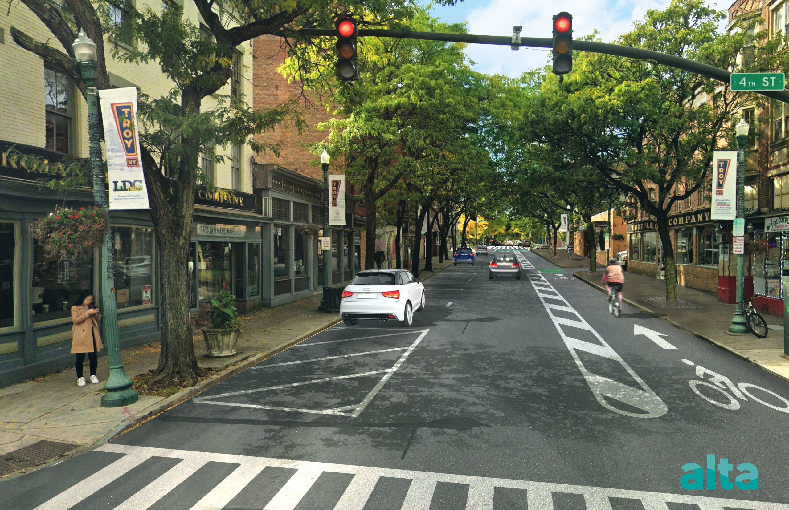
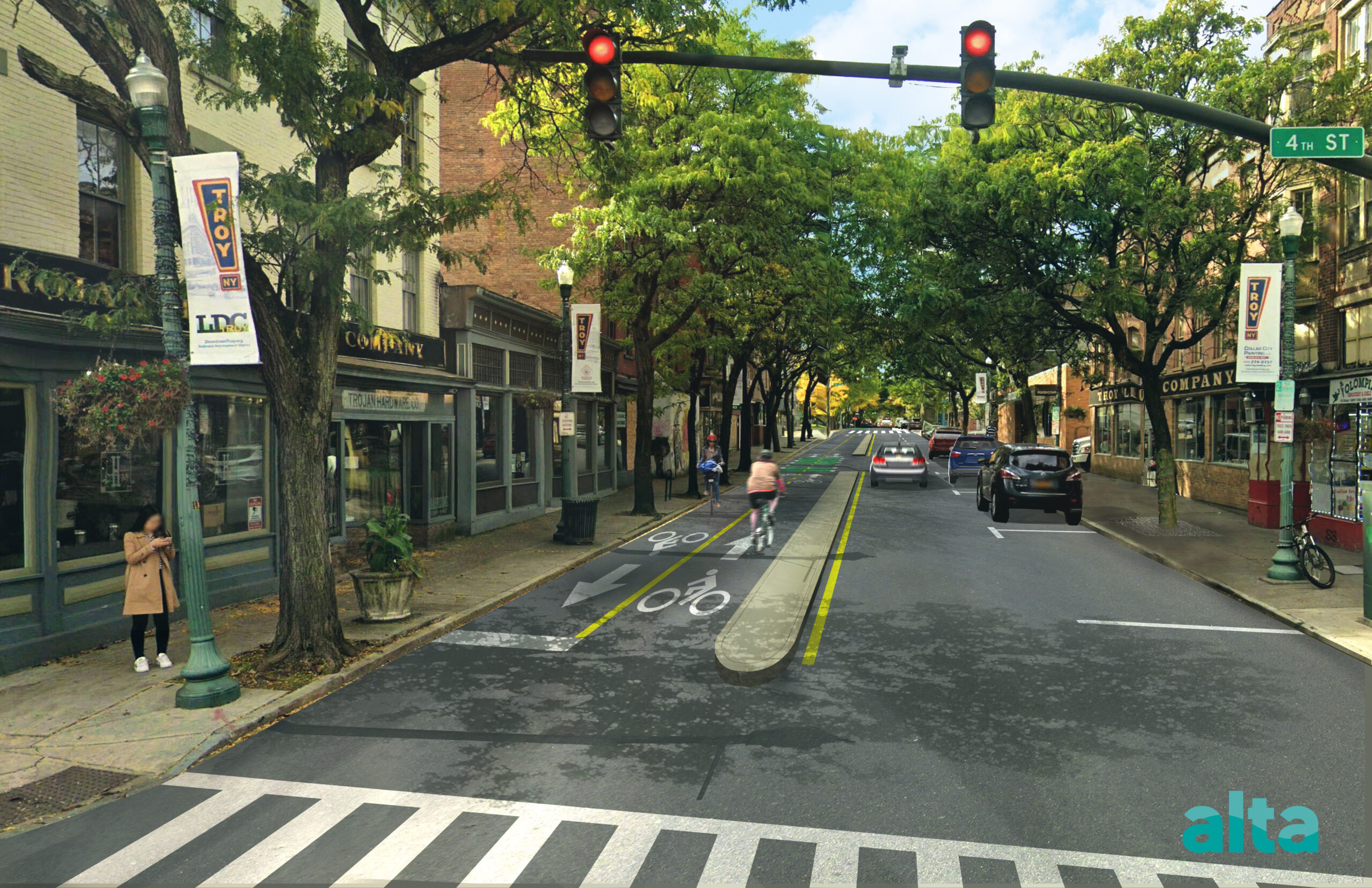
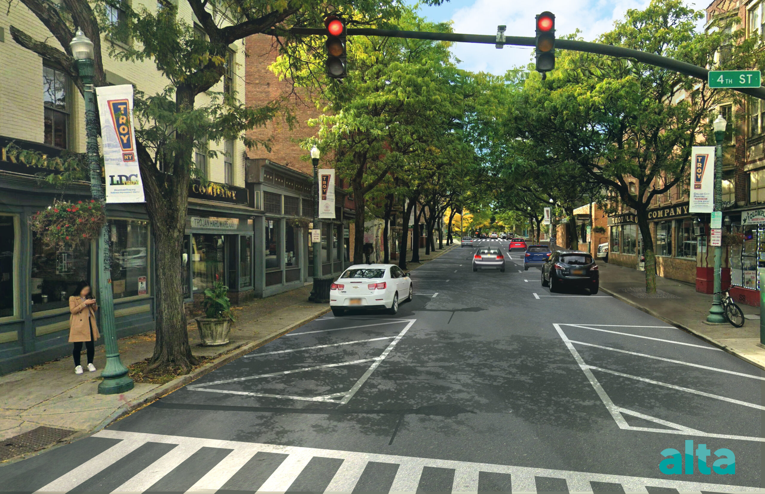
Photo Simulations
Explore the photo simulations of the project alternatives considered for this project.
Click each image to view a large version.
Project Alternative Concepts
The project considered three alternatives as shown in the concepts below. A description of each alternative is as follows. Please refer to the Draft Design Report to review the most up to date alternatives under consideration and apparent preferred alternative.
Click each image to view a large version.
Common Design Elements in all Alternatives
During concept development of this project, the Consultant team had developed three different alternatives. The primary differences between these three alternatives is how they each provided infrastructure for bicyclists and thereby transformed the designs of NY Route 2 (Congress Street and Ferry Street).
- The intersection of River Street and the Congress Street Bridge would be rebuilt as a new 4-way intersection.
- The southbound, one-way portion of 5th Avenue between Congress St and Ferry St would be changed into a two-way road.
- Portions of sidewalk and curb ramps that do not meet ADA and PROWAG standards would be replaced.
- Green conflict markings would be added where proposed bicycle facilities continue through intersections.
Key elements of each alternative are identified below:
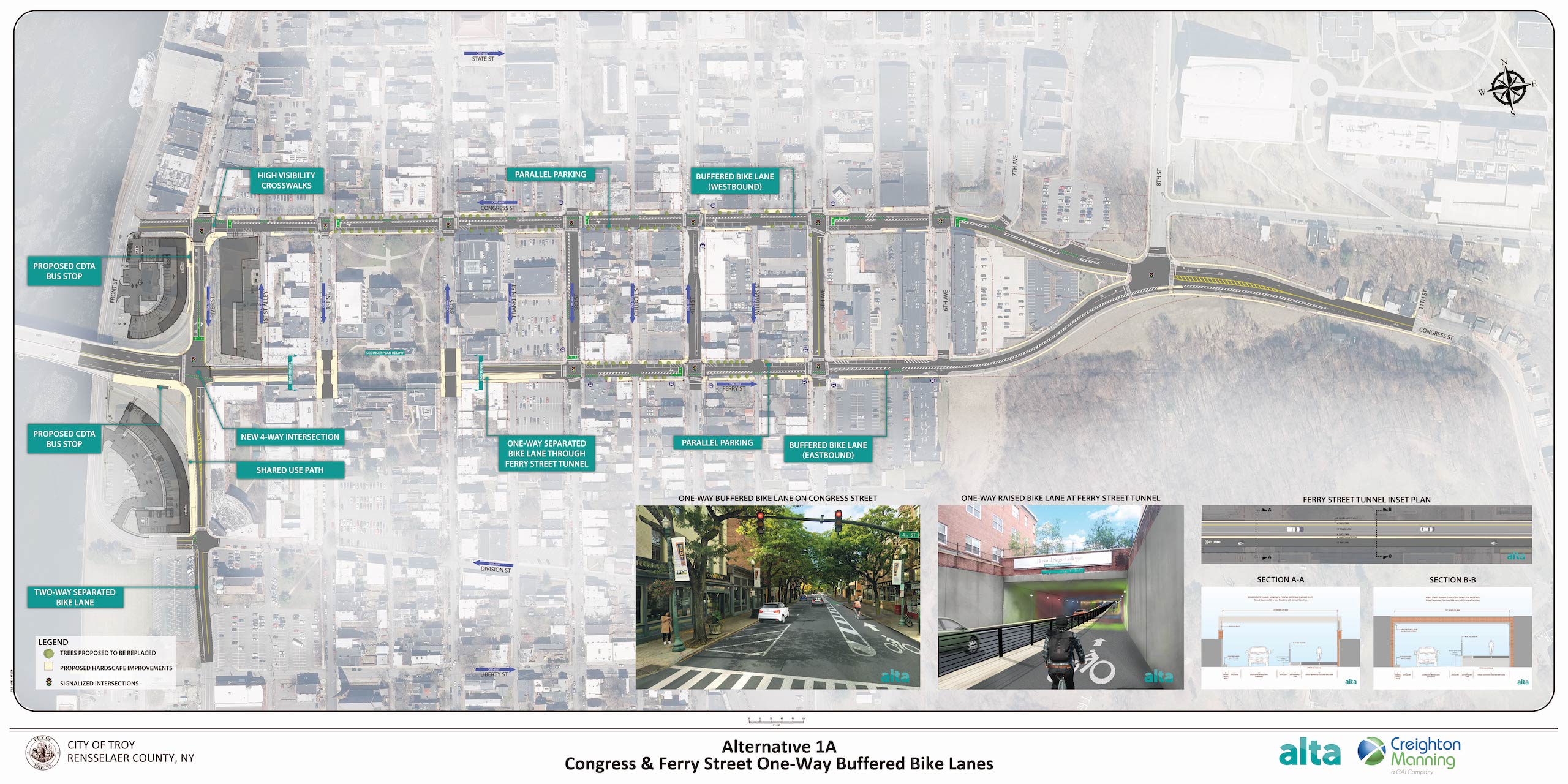
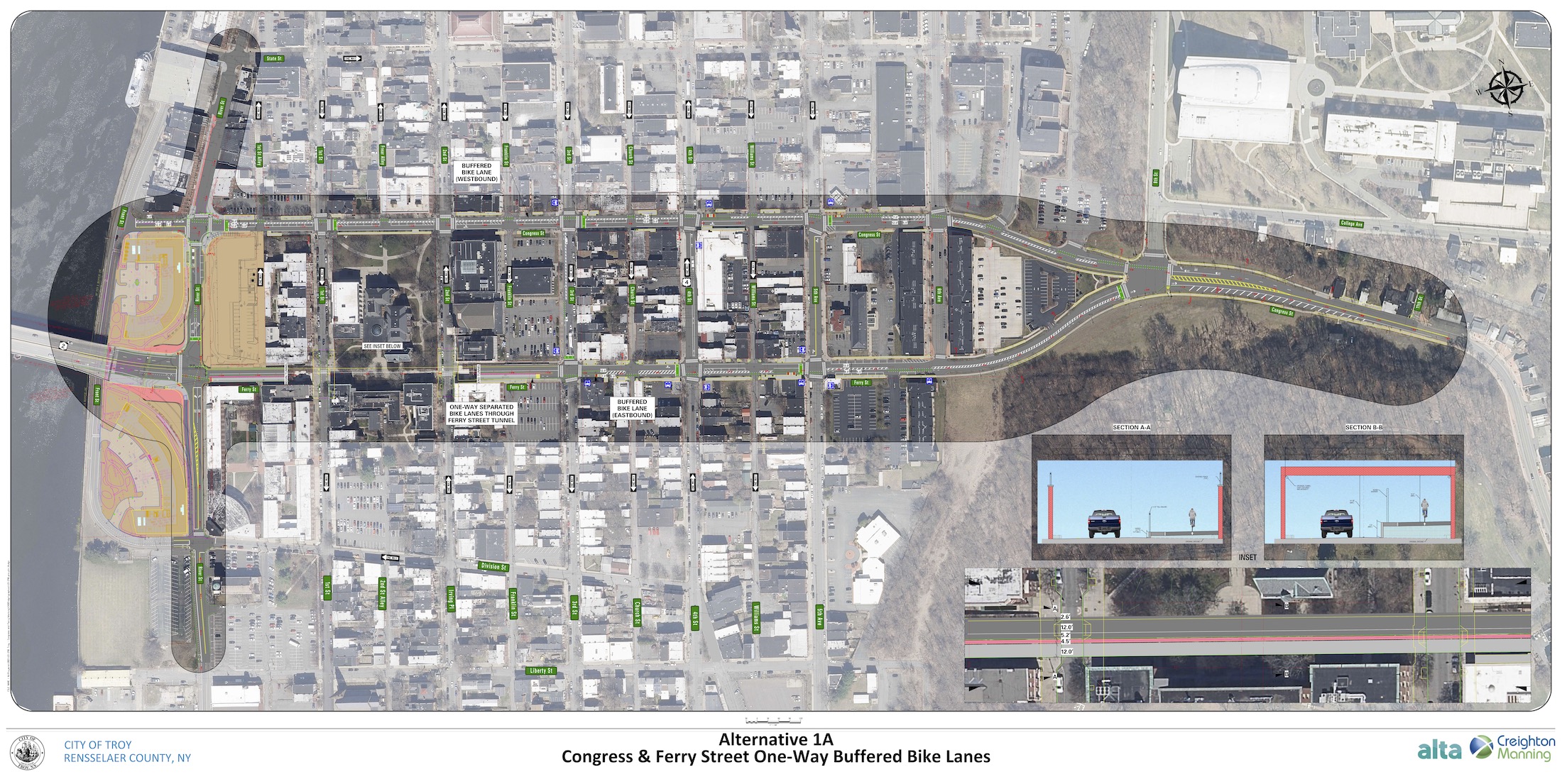
1A – One-Way Buffered Bicycle Lanes on Congress St and Ferry St
- Congress St – Single travel lane with parking along south side
- Ferry St – Single travel lane between 2nd St and 5th Ave with parking along north side
- One-way buffered bicycle lanes from Front St to 6th Ave.
- Ferry St tunnel – Elevated concrete median and bicycle lane to separate bicycle lane and travel lane
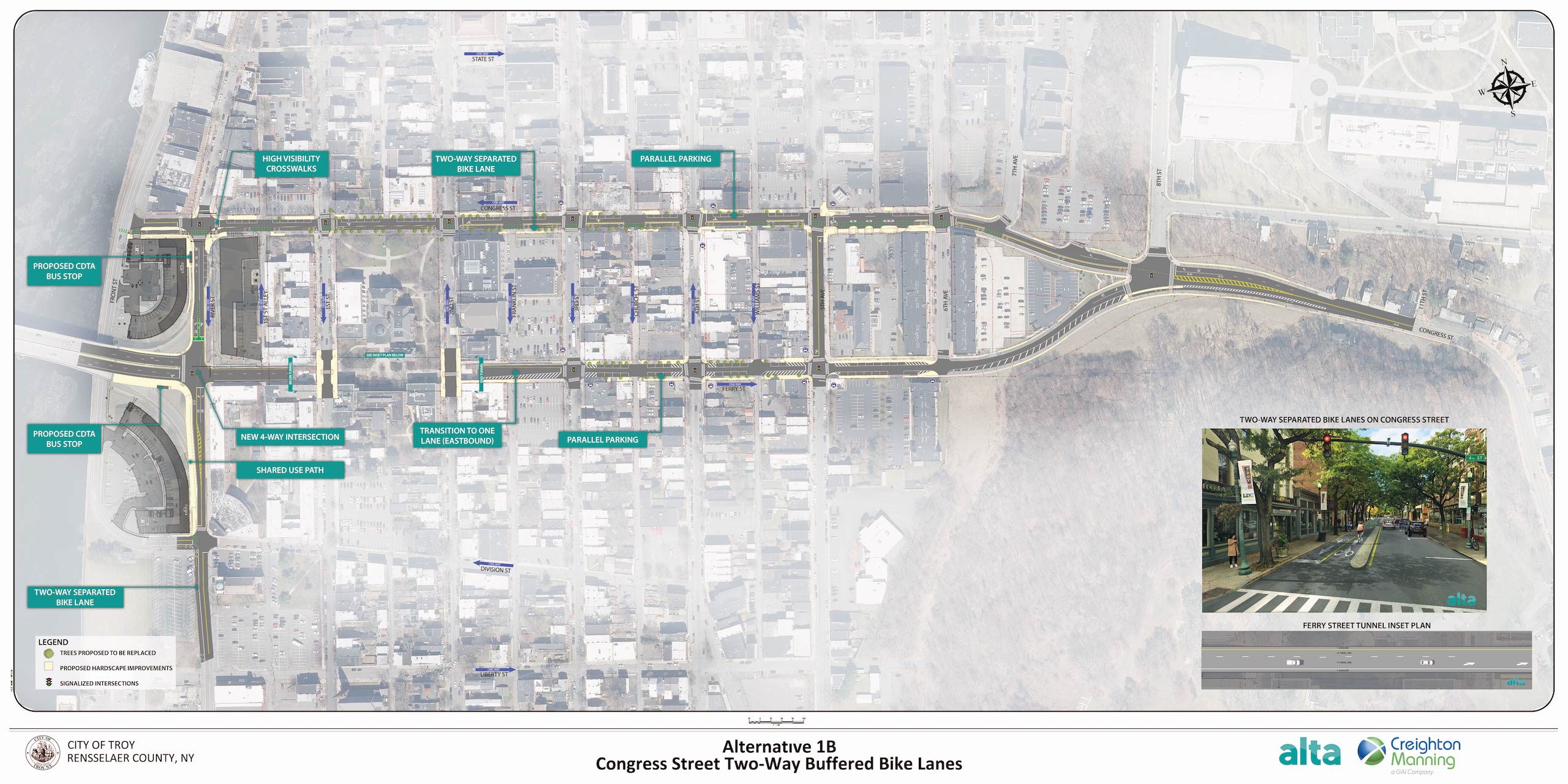
1B – Two-Way Buffered Bicycle Lanes on Congress St.
- Congress St – Single travel lane with 10-foot-wide, two-way buffered bicycle lane from Front St to 6th Ave. Parking along north side.
- Ferry St – Single travel lane with parking on both sides
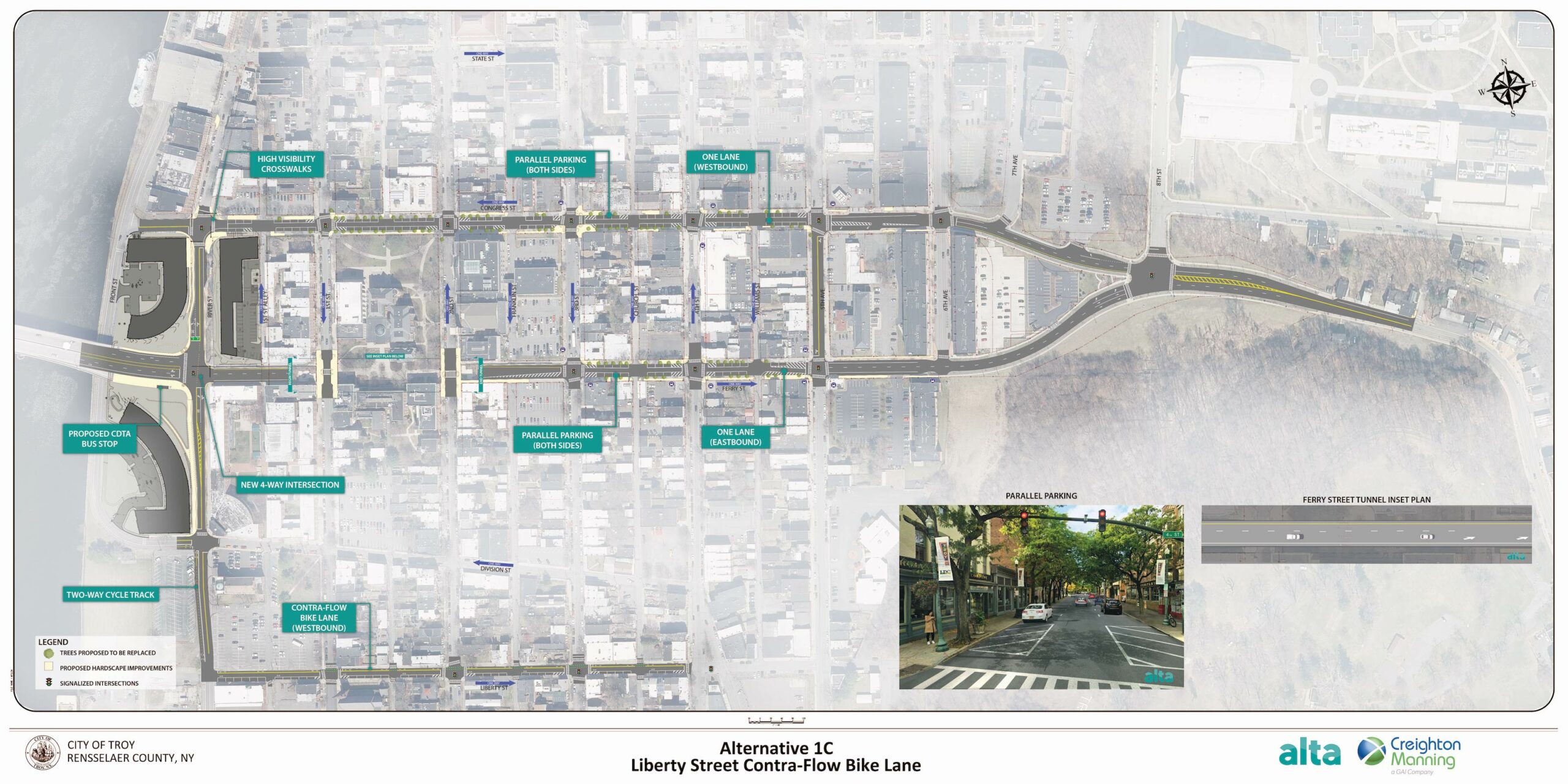
1C – Road Diet on Congress St and Ferry St with Counter-Flow Bicycle Lane and a Shared Lane on Liberty St
- Congress St – Single travel lane with parking on both sides
- Ferry St – Single travel lane between 2nd St and 5th Ave with parking on both sides
- Liberty St – Contra flow bicycle lane (westbound) and shared lane markings (eastbound)
Leave a Comment
We want to hear from you! If you have concerns or ideas you’d like to share, please provide a comment below, or download, print, and send your comments to the team at the following address:
Creighton Manning Engineering
Attn: Jeff Pangburn, PE
2 Winners Circle
Albany, NY 12205
Documents
Download the following documents to learn more about this project.
Events
Up Next
Stay tuned!
Past Meetings
Public Informational Meeting
July 30, 2024: 6:00 pm - 7:30 pm
Russel Sage College’s Bush Memorial Center
50 1st Street,
Troy, NY 12180
[Google Maps]
Public Meeting #2
October 9, 2024: 6:00 pm - 7:30 pm
Italian Community Center
1450 5th Ave, Troy, NY 12180
[Google Maps]
Download the flyer